My sleepless wanderings on the last night of our voyage lead me to the
bridge. The clouds to the east are lit from below with a yellow hazy
glow - Perth nightlights. The city itself is still under the horizon
but the towering lighthouse on Rottnest island periodically waves its
strobe our way. Recalling a simplified calculation that Nathan and I
performed yesterday, regarding how far we could see until the Earth
curves under the horizon - the city is at least 100km away.
No shift tonight. Once we entered Australian waters some 15 hours ago,
there was no need for further data logging since the international
dataset is pretty substantial over the continental shelf. Getting our
sleep cycles in order was of high priority even though a few others
and I are still walking up and down the corridors.
We have been commuting in a straight line for the past 3 days
collecting our last magnetic track. As a parting gift from Poseidon we
were offered 8 meter high waves with rolls of over 10 degrees. When it
was time to pull the magnetometer back in for the last time, I went on
deck to assist in manoeuvring it with ropes away from the side of the
ship. The waves were rising up like blue walls over our heads, coming
so close but never too close thanks to the ships buoyancy. Definitely
one of the exciting moments of the voyage. Its funny how seasickness
is amplified inside the ship whereas on the deck I couldn't feel a
thing. Maybe it was the adrenaline too.
Soon the pilot ship will be available to escort us into Freemantle
port. Getting the magnetometers loaned to us by the Australian
Geological Society shouldn't take too long and other than that only
the buckets of rock samples from the dredges will need to be unloaded.
In the next few months we will start to put together the clues we have
collected for the past 20 days. Magnetic tracks will help us gain
insight to the ancient spreading directions and rates of the Southeast
Indian Ocean, adding to the resolution of global tectonic kinematic
reconstructions. Thin sections of the many oceanic and continental
rocks we collected will be used to further constrain timelines and
raise new questions about what kind of margin or extinct ridge lies in
the Perth Abyssal Plain. Just imagine a huge chunk of continent,
braking off painstakingly slowly, tens of millions of years ago, and
being left behind as the rest of the continent speeds north perhaps to
create the Great Mountains of Asia. This may all be entirely premature
or even totally wrong - is that not the beauty of science?
Wednesday, November 9, 2011
Thursday, November 3, 2011
A Mexican Party
What day is it?
Routine and a lack of change in the surroundings have blurred all
higher order of time. Only the arbitrary relativity to the shifts
start and end points has any meaning. Asking what day it is might just
be left unanswered.
Who knew ?! Coffee also comes in teabags, or should I say coffee bags.
I found these little sacks of coffee in a can in the galley."Mocha
Kenya style", each with its own multicolour string and cardboard for
dunking, KGB interrogation style, in and out of boiling water. For
easy use and disposal, no mess - no stress. Ahhh.. the little things
in life.
Most of the magnetic analysis and mapping is done using a UNIX
open-source prompt line programming language called GMT. Very
powerful, but as a wise man expressed to me before the cruise:"
welcome to a world of pain". I can safely say that he was right - but
hey, no pain no gain! Following 3 consecutive red-eyed nights, I have
mastered the basics and even produced some pretty good plots.
After swathing Dirk Hartog ridge two days ago, it was decided that
dredging the site would be postponed by a week, for our way back to
Freemantle. Instead, we headed west to Gulden Draak seamound to carry
out the same ritual. Remember that the point of our dredging
shenanigans is to hopefully recover some specimens that will clearly
explain the origin of the seamounts. Its always a gamble, albeit a
educated one.
Hours of watching cable tension figures as the dredge net is being
reeled in can be nerve wracking (for the geochem team). Only the
highly experienced can decipher this series of numbers. Is the sack
empty? Has it spilled? As the bulging nets gaping metal mouth rises
above the waterline, sighs of relief are released all round. Best
dredge ever!
We spoke too soon. Twenty minutes later the net was still full,
hanging like a Mexican piñata above the weather deck, swaying to and
fro - nearly decapitating a few heads. Don, our CSIRO liaison officer,
and "The Winchman" were taking turns swinging 5kg sledge-hammers.
Matters were worsened by the second mate, Tom, screeching from the
dog-house to "Give it to her" and doubling over with laughter. We
would have laughed too, had the back gates been closed, but they were
open and the thought of the guys swinging the wrong way and sliding
down the ramp like dead whale blubber did cross a few minds.
Eventually the piñata broke, releasing all its goodies. Metamorphic,
sedimentary and perhaps even igneous rocks fell everywhere. Even two
large rounded pebbles rolled about. This means months of painstaking
microscope work with the slides, but possibly good things for science.
Sunday, October 30, 2011
En route
Captains Log: 26.22.856S/101.29.132E; Heading 125 towards the Dirk
Hartog Ridge. ETA - 1.5 days.
Trending roughly north to south, the Dirk Hartog Ridge is a series of
elevated, elongated seamounds that separates the eastern and western
Abyssal Plains. Like Batavia Knoll, little is known of this underwater
ridge, which rises 3km above its surroundings. Hypotheses include an
extinct spreading axis, the result of faulting or perhaps the end
product of an interaction between mantle plume rise and seafloor
spreading. Once we arrive, our usual ritual of grid bathymetry
swathing and dredging will commence.
Until then we continue to collect magnetic anomaly tracks. The
preliminary analysis of the data gathered so far has raised some very
interesting ideas, but further work will be needed to make any
substantial claims.
I have resumed a short exercise regime comprising mainly of the wind
friction static bike. Normally I would not be caught pedaling in a
gym, but the reality of being enclosed in a buoyant tub in the middle
of the ocean prevails. Since the treadmill has been put out of order,
and fitness balls just arent my thing, the bike is my only refuge.
Interestingly, while riding on the bike I am totally oblivious to the
rolling and pitching of the ship, I guess because these are normal
motions on a bike and my body expects them. Another torture device in
the so called General Lab is the rowing machine - it seems pretty
hilarious to be rowing in a room, on a ship, at sea.
0600a.m. the end of my shift is getting close. Excuse my musings.
The need for fresh air draws me to the weather deck, teacup in hand.
Staring out across the dark choppy sea and a sky full of clouds, I
cant help noticing the vast expanse of nothingness above, while
remembering the intricate mysteries we are all trying to decipher
below. Hidden from the casual glance, the seas history is encapsulated
in the rocks and their physics. The movements in the earth, whose
timescale is near completely unfathomable by the human mind, all
packed and coded in a magnetic message from the deep.
Illuminating the virtual horizons of my thoughts are questions about
the evolution of life. Some have been answered, I am sure, others
perhaps still a void waiting to be filled. How did life evolve hand in
hand with the changing magnetism of the Earth? How did the drifting
continents fuel and extinguish different evolutionary routes? How is
it that life from virtually every kingdom come to rely on the changing
magnetic field? And what about us ? do we?
Wednesday, October 26, 2011
Batavia Knoll
Northwest of the Perth Abyssal Plain is a long NE-SW trending trough,
with two large seamounts on top of it. The trough is suspected to be
an extinct mid-oceanic ridge and the seamounts origins are largely
unknown. The northern seamount is called the Batavia Knoll, probably
after some German or Dutch discoverer, and is easily recognized as a
high anomaly on the gravity maps of the region ? this was our first
dredge site.
First order of a dredge is major SWATHing of the area to get a very
good understanding of the seabed bathymetry. We SWATHed back and
forth for 12 hours along a zig-zag path above the underwater
mountain, revealing a steep 4km drop from the unusually flat top to
the trough. Another interesting attribute was the high amount of
gullies leading to the trough relative to almost none going down to
the Abyssal Plain on the other side.
Choosing the best dredge line is not very difficult bit still demands
careful consideration, depending on your objectives. Since we aim to
understand the origin of Batavia Knoll, a line with the least
possible sediment was needed, preferably a fault scarp, in order to
get to the crystalline basement of the feature. It was decided that
one of the gullies leading down to the trough would be dredged. The
captain took us over the gully 4 times until he was confident that
the depth soundings were accurate and no potential snags awaited
below. Needless to say, many dredge nets have been lost to the abyss
so all precautions must be taken.
As day broke the crew lined up in their orange overalls on the back
deck to let out the gear. The dredge net is made up of a rectangular
metal box, resembling a mouth, on the one end of which a large
heavy-duty chain mesh cage is attached. Also attached to the mouth
are two metal canisters meant for picking up loose sediment.
Back in the Ops room we anxiously watched the winch cable tension for
spikes. One spike too many and the 5ton cable could snap leaving our
net at the bottom. Luckily the first mate of the ship has never lost
a net yet.
Our on-board geochemists: Jacqueline Halpin, Nathan Daczko, Maddy
Kobler and Robyn Gardner, are ecstatic about the loot. Big chunks of
felsic continental rocks with huge crystals, mafic amphibolites and a
huge bright gold sandstone nugget have been dredged up. Put together
these might have big implications for the evolution of Batavia Knoll.
Could this be a piece of India left behind as it slowly waved goodbye
?
Sunday, October 23, 2011
Faulty Mags
Somehow, it seems like we've been at sea for much longer than three days. So much has happened; I've talked to so many people, learnt so much, slept so much, eaten so much, and even managed to watch a few movies. My graveyard shifts in the Operations Room have become much easier; perhaps I have overcome jetlag and mild seasickness. Nonetheless, the sign of sunrise through the 20cm wide salt encrusted starboard porthole, which marks the end of my shift, is still a delight.
Growing pains turned into bite marks today.
Owing to the fact that the magnetometer is 200m behind the ship, we initially set up our software to calculate its actual position by adding 200m to the on-ship GPS reading. For some unknown reason, however, during the second day the positions we got were a few kilometers southwest of where they should have been. Henceforth we decided to give it up and manually recalculate later in the post cruise analysis.
As if that was not enough, sometime after our seventeen hundred hours dinner, a call came up from the Op's room that the mag. readings were spiking. A brief inspection quickly revealed that every 5 seconds or so a negative spike of about 30-50nT (nanoTesla) was being recorded. We quickly headed up to the aft weather deck in order to fire up the screeching winch and reel in our towed torpedo. In a light drizzle under overcast skies driven by 26knot winds, the waves were picking up. Nothing too high but still - the drama accumulated. From my vantage point in the "Dog House", a control booth for the sterns hydraulic boom, I watched as the crew maneuvered the magnetometer aboard.
The first thing apparent about the brand new Flipper I were the bite marks. Observing the deep undulating cuts and index finger sized holes in the thick orange rubber, the only word to come to mind was "shark". Just like those horror documentaries that film unsuspecting swimmers from underwater, the unsuspecting magnetometer, mistaken for a yummy seal was mutilated. Flipper II was called to the mast, and no sooner was she towing behind and sending out good readings, we doubled back 5km and re-recorded the faulty zone.
Apparently, one can follow the rise and fall of plankton masses during the day and night on the 38 kHz echo sounder. I haven't been paying attention to that screen, since there are another 19 screens in the Ops that change constantly, but I intend to from now on. More on that soon if I notice anything.
We are currently at 25o10?889??S/103o24?865??E heading 307o at 9.6knots. Long ago we left the normal shipping routes and there have been no vessels in sight since. There is lightning on the horizon and I hope the weather won't catch up with us.
"Lamington" a square of sponge cake dipped in chocolate and grated coconut / Oxford English Dictionary.
If you thought that the Southern Surveyor doesn't have a patissier - think again. Off to warm up with some soy Milo and Lamington.
Friday, October 21, 2011
High Seas
Acquiring my sea legs has taken me two days, and they're still not very steady. The swelling sea causes our vessel to pitch and roll constantly, making it hard for some of us, myself included, to concentrate on our work. Using highly toxic anti-nausea tablets backed up with homeopathic placebos I have been able to ward off the tremors but occasionally it's all too much and a retreat to my dark cabin must be made.
Two datasets are being recorded as we sail: sea level magnetic field data and multibeam (swath) sonar of the seafloor topography. The magnetometer looks like a small orange torpedo and tugs along quietly behind the boat at roughly 40 meters below sea level, adapting constantly to our cruising speed of around 10 knots. It records the total magnetic field observed along our course, meaning the current field, solar radiation and remnant magnetism of the seafloor. While analyzing the data we will have to clean out the Earth's current field and any solar interference in order to isolate what we're really interested in - the paleomagnetic field recorded in the oceanic crust over the past 130 million years.
The Simrad EM300 swath sonar resembles a large gondola welded to the bottom of the hull and sends out more than a hundred pings each instance. Using the travel time, amplitude and phase shifts in the return beams reflected off the bottom, the computer calculates the depth, i.e. bathymetry, of a ~1000meter wide slice perpendicular to our forward vector. Using these slices it is easy to comprise a 3D image of the seafloor which will be important when interpreting the magnetic anomalies in the data and choosing optimal dredge sites in a few days time. Of course, water salinity, temperature, density and conductivity also play a role in determining sound wave velocity - hence all these parameters are collected, albeit currently only at surface level. Currently we are getting depth readings ranging from 3900 to 5100 meters. This is well beyond the intended resolution of the EM300, but it nonetheless confirms we are above an abyssal plain.
Basically, our job is to make sure the instruments are recording correctly and that the magnetometer hasn't been torn off the back by some Great White mistaking it for a midnight snack. Logging down the data every 15mins in a notebook is our failsafe in case something unimaginable happens to the hard drives.
I have been placed in the graveyard shift: 2am to 8am. Together with my comrade at arms, Adriene Bronner a Ph.D. student from Strasburg, we keep log and raid the stores in the galley during the small hours of the night. The ships dinner is our breakfast, so starting the day with a Tbone steak and mash is a dream come true. I must hand it to Mick the steward et al. - they do keep us happy.
Keep in mind that the science is our main mission. When we pre-analyzed the data on line and discovered that we had just entered the Cretaceous Quiet Zone Superchron, an wave of muffled excitement broke out in the Op's room. This is what we are here for - boldly going where no man has gone before.
Thursday, October 20, 2011
Hong Kong to Freemantle
A hectic journey it has been.
Having a 9hr layover in Hong Kong it seemed obvious that I should have a look around. While gliding through HK airport, a westerner, like myself, immediately notices the out of place smells of simmering oriental spices wafting over the shining floors between electronics and lights. As if new age industry and technology have taken over the place but the heart has remained the same.
The MTR train ride into Hong Kong Central left me in awe of the punctuality, cleanliness and overall quality but yet again I couldn't help wondering why Israel hasn't gotten its act together tackling this elementary subject. Surrounded by hi-tech and every imaginable bank logo, it is easy to see why Hong Kong is regarded as one of the finance and trade centers of the world. So many people in such a bustle made me instinctively walk fast but none of them seemed in a hurry. Again the west is in the east but the heart has remained the same.
From then on though, it was a different story. Reflecting now, I am reminded of a lecture I heard regarding the disproportionate influence some negative memories can have over an overall good experience. Granted, 9 hours is barely enough to get your bearings in HK, but still – the in-situ development of mild epilepsy and visual disorientation syndromes was a bit much. Everywhere I looked someone was selling something, and I wasn't buying. Even though I had a short shopping list, the sheer atmosphere of around the clock commerce put me off. I got barely half way down my list before I just had to get out. I found my refuge in a large mug of ice-cold Chrysanthemum Honey Juice – highly recommended.
The quiet colonial coastal port town of Freemantle, with its wide streets, a cool sea breeze and unfamiliar bird songs coming down from the tall alpine trees is Hong Kong's exact opposite. Not a single building is over 3 stories and the sky is clear and blue. Just what I needed. We arrived at the Research Vessel Southern Surveyor berth and boarded, only to find that most of the scientific team hadn't arrived yet. Just as well, because I could grab the bottom bunk in my assigned cabin "scientists 4 & 5". No worries – my top bunk partner Jack Healy has a safety net in case of high seas.
It's funny how the olfactory system is the most effective way of bringing dusty memory neuron passageways back to life. The "aroma" of a ship is not one to be forgotten. Between barging in southern France, yachting in the Mediterranean and cruising in the Galapagos archipelago – the Southern Surveyor is no smelly exception. It's hard to describe the damp woody smell mixed with a bit of grease, salt and PVC floors – but I just tried.
There's a certain camaraderie immediately formed between shipmates, perhaps due to the close quarters they are forced to inhabit. The crew seems to be awake at all hours hauling something this way or that in their orange jumpsuits, but always stop to say g'day and see if you're OK. I started my first morning with a run on the treadmill followed by bacon and eggs an soy milk sultana bran… ahhh the good life! Too bad I had a look at the shift roster and found out I'm on from 0200 to 1400.
Well, my last minutes on land are over. Luckily the Freemantle Library offers free WiFi to the whole city so I can send this out while sitting on the park lawn. Back to the ship for the safety drill after which we cast off and immediately lower down the magnetometer.


Monday, October 17, 2011
Here I Come
Today it begins.
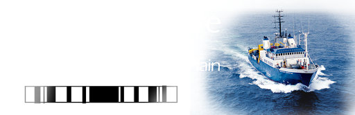
We are flying to Perth-Australia to embark on a 21 day oceanic expedition to the Perth Abyssal Plain aboard the Australian national marine facility – the R.V. Southern Surveyor. This 66 meter long four story vessel will be our home for the next three weeks as we gather magnetic and sonar data and collect seafloor dredge samples. Owing to his extensive experience at this kind of thing, my supervisor Dr. Roi Granot says it's going to be an experience never forgotten.
The Perth Abyssal Plain is situated in the south-eastern Indian Ocean, offshore southwest Australia and has water depths between 1000 to 5500 meters deeming it a true abyss. It is what geologists call a passive margin meaning it is the no longer active transition zone between newly created oceanic crust and the continent. Roughly 130 million years ago, supercontinent Eastern-Gondwana broke up and India separated from Australia and Antarctica, eventually leaving behind a plain of oceanic crust littered with continental fragments such as underwater ridges and knolls.
Our journey will take us fairly perpendicular to the spreading axis of the ocean, in order to gather marine magnetic anomaly data sets used to reconstruct the spreading history of the plain. Interestingly there are a couple of different tectonic reconstruction solutions regarding the early birth of the Indian Ocean and hopefully our investigation will be able to help add further constraints and a more regional picture.
With three flights and about 14000 kilometers ahead of me before my wobbly foot touches the gangplank, there's still a long way ahead. Thoughts of the uncanny combination of magnetism, Australia and a certain island based TV series need to be put out of my head. Considering the assurance my insurance agency gave me that after "only two short weeks" of no communication they will come and rescue me I brought my inflatable cushion just in case.
The waiting has finally come to an end and I'm buzzing with excitement.
But, first thing's first. Hong Kong – here I come!
Subscribe to:
Posts (Atom)